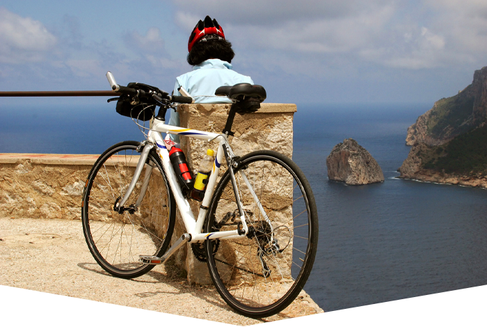
Best cycling routes in
Mallorca
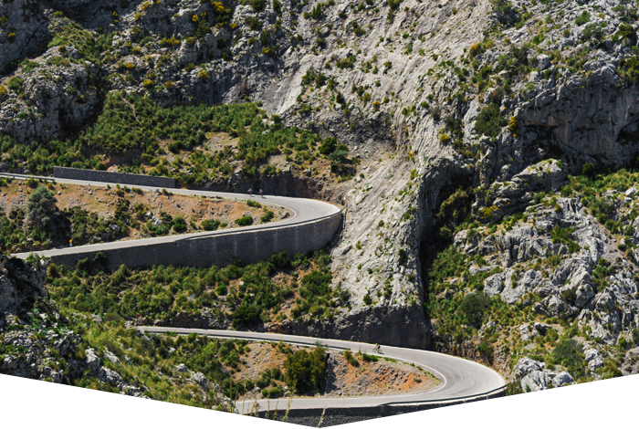
Mallorca has a road network of 1,250 km, about half of which are local and secondary roads with an average width of 6.50 metres approximately, of which 20% are in the mountains. Some of the main roads have designated bike lanes painted in red or blue to the side of the road.
The Tourist Information offices often have information about cycling routes and there are several books on sale about cycling on the island, such as Cycle Tourism Routes Around the Island of Mallorca – publisher El Gall Editor SL.
In most of the coastal tourist resorts there are bicycle hire shops which rent out a variety of bikes including road, mountain, suspension, tandem, city, children’s bikes and tagalongs. They also have helmets and child seats for hire. Some will deliver bikes to the property you are staying in. There are usually signs indicating cycling routes, especially through the country lanes and a speed limit for cars is also indicated. In certain areas there are also maps at the side of the road showing the cycling routes.
Some Great Cycling Routes In Mallorca
If you are staying in one of the villas in Pollença on your trip to Mallorca, there are many local routes in the Pollença area, some of which are through country lanes:
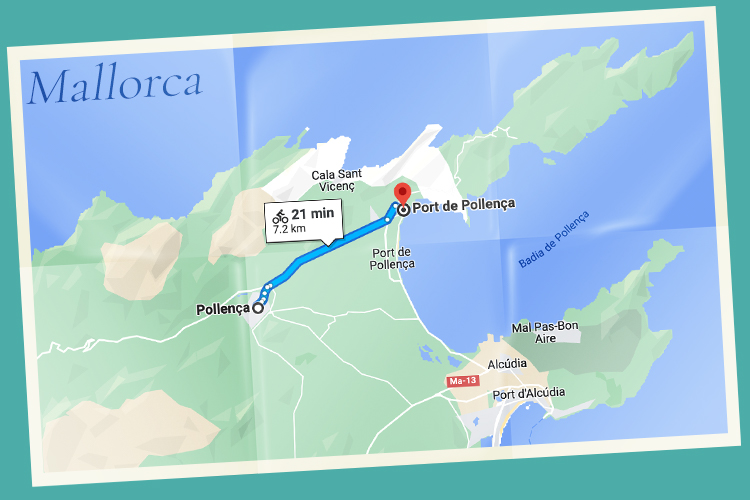
Pollença – Port de Pollença (8 km)
View the route on Google Maps
Pollença – Campanet (16 km)
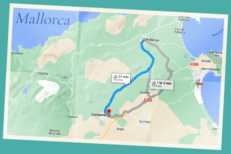
View the route on Google Maps
Port de Pollença via Llenaire, Bay of Pollença and Llenaire – Pollença – Port de Pollença (11 km)
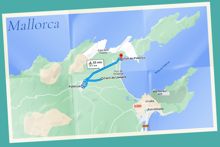
View the route on Google Maps
Pollença – Cala Sant Vicenç (7 km)
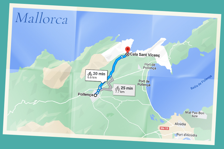
View the route on Google Maps
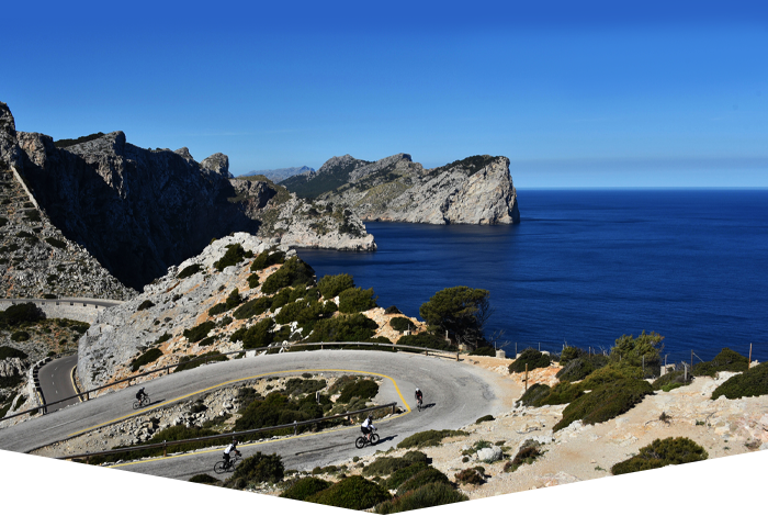
Pollença – Cap de Formentor (23 km – classed as difficult)
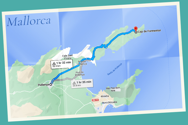
View the route on Google Maps
Going Further Afield:
Caimari – Binibona – Campanet – Pollença – Port de Pollença (30 km)
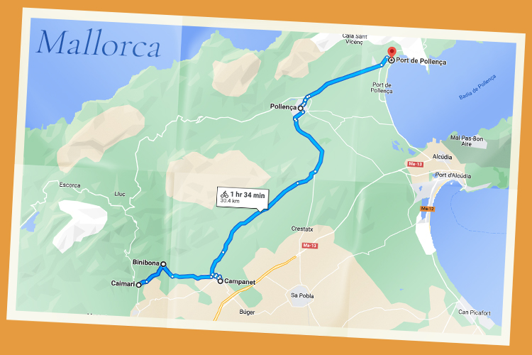
View the route on Google Maps
Campos – Ses Salines – Santanyí – S’Alqueria Blanca – Felanitx (38 km)
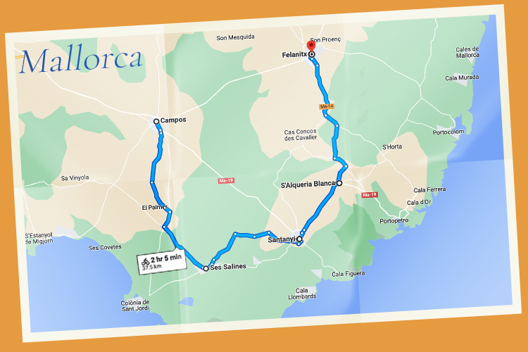
View the route on Google Maps
Artà – Son Serra de Marina – Ca’n Picafort – Alcúdia – Port de Pollença (48 km)
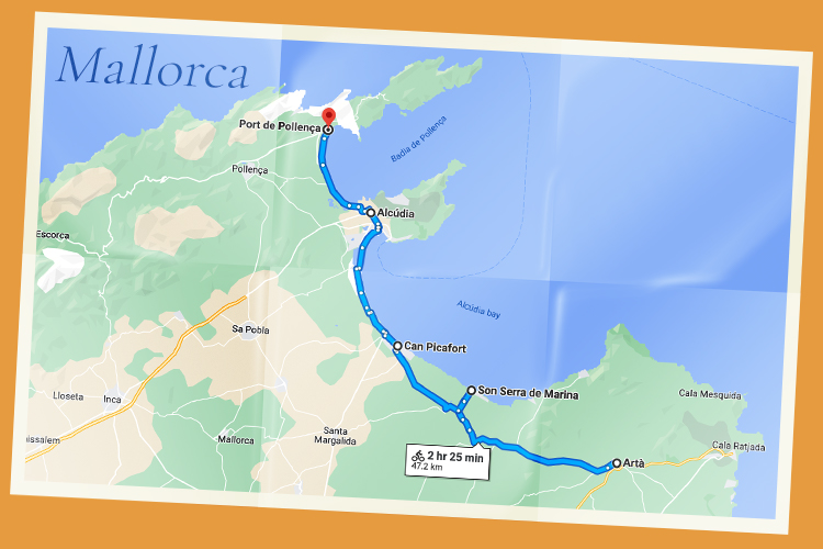
View the route on Google Maps
Circular routes:
Sencelles – Santa Eugènia – Sencelles (14 km)
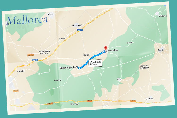
View the route on Google Maps
Llucmajor via Capocorb Vell – Llucmajor (26 km)
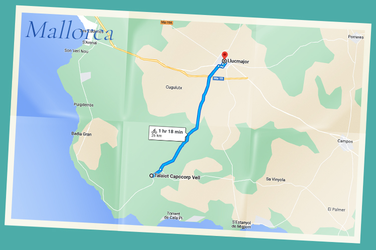
View the route on Google Maps
Algaida – Sencelles – Ruberts – Pina –Algaida (28 km)
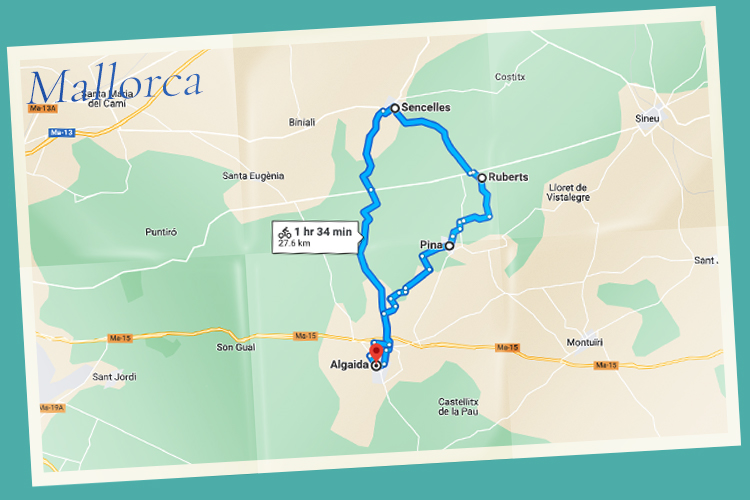
View the route on Google Maps
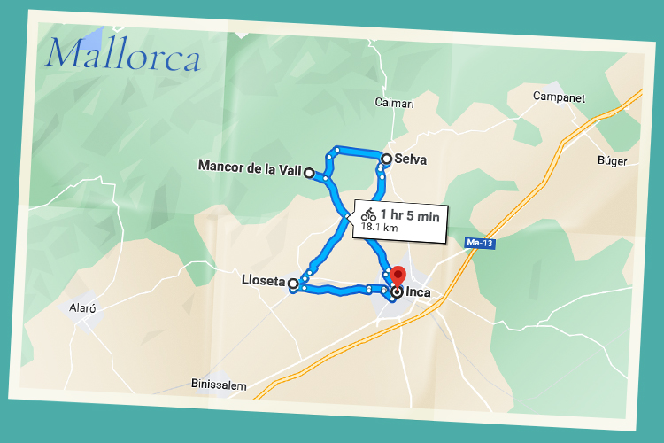
Inca – Selva – Mancor de la Vall – Lloseta – Inca (18 km)
View the route on Google Maps
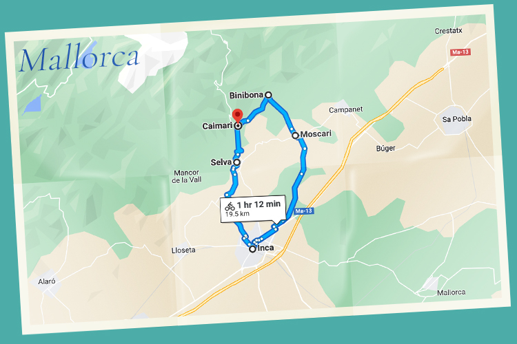
Caimari – Binibona – Moscari – Inca – Selva – Caimari (20 km)
View the route on Google Maps
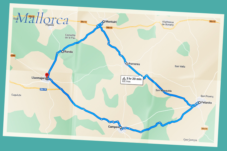
Llucmajor – Campos – Felanitx – Porreres – Montuïri – Randa – Llucmajor (64 km)
View the route on Google Maps
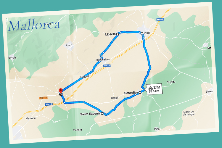
Santa Maria – Santa Eugènia – Sencelles – Inca – Lloseta – Santa Maria (39 km)
View the route on Google Maps
Manacor – Son Carrió – Son Servera – Artà – Son Serra de Marina – Manacor (70 km)
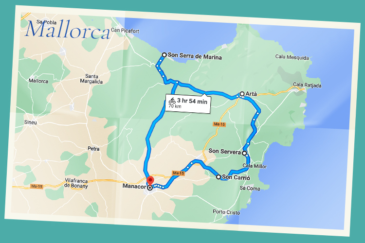
View the route on Google Maps
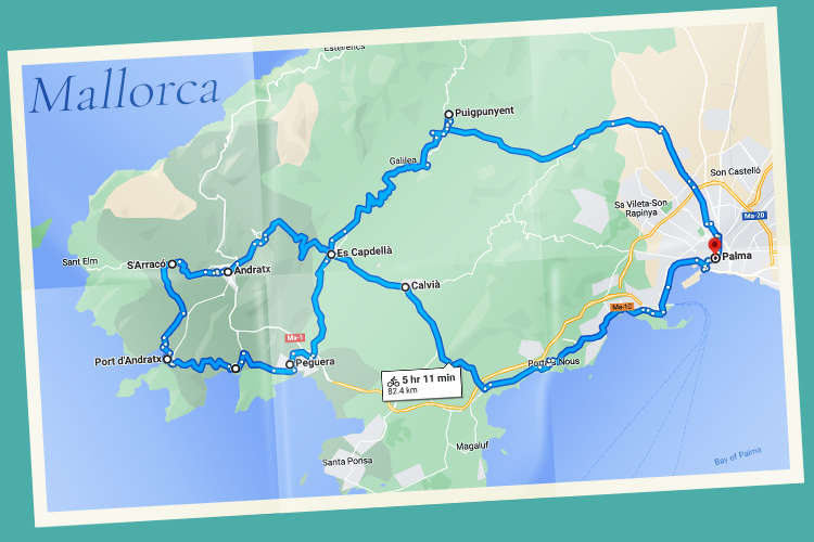
Palma – Puigpunyent – Es Capdellà – Andratx – S’Arracó – Port d’Andratx – Es Camp de Mar – Peguera – Es Capdellà – Calvià – Palma (83 km)